Back مقاطعة إيري (أوهايو) Arabic اری بؤلگهسی، اوهایو AZB Erie County, Ohio BAR Ери (окръг, Охайо) Bulgarian ঈরী কাউন্টি, ওহাইও BPY Erie Gông (Ohio) CDO Erie County (kondado sa Tinipong Bansa, Ohio) CEB Erie County, Ohio Welsh Erie County (Ohio) Danish Erie County (Ohio) German
Erie County | |
|---|---|
 | |
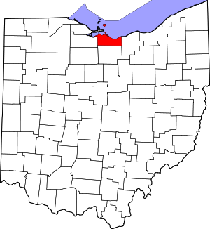
 Location within the U.S. state of Ohio | |
 Ohio's location within the U.S. | |
| Coordinates: 41°31′N 82°37′W / 41.51°N 82.61°W | |
| Country | |
| State | |
| Founded | March 16, 1838[1] |
| Named for | Erie tribe |
| Seat | Sandusky |
| Largest city | Sandusky |
| Area | |
| • Total | 626 sq mi (1,620 km2) |
| • Land | 252 sq mi (650 km2) |
| • Water | 374 sq mi (970 km2) 60% |
| Population (2020) | |
| • Total | 75,622 |
| • Density | 120/sq mi (50/km2) |
| Time zone | UTC−5 (Eastern) |
| • Summer (DST) | UTC−4 (EDT) |
| Congressional district | 9th |
| Website | eriecounty.oh.gov |
Erie County is a county in the northern portion of the U.S. state of Ohio. As of the 2020 census, the population was 75,622.[2] Its county seat and largest city is Sandusky.[3] The county is named for the Erie tribe, whose name was their word for "wildcat".[4] It was formed in 1838 from the northern third of Huron County and a portion of Sandusky County.
Erie County is included in the Sandusky, OH Metropolitan Statistical Area, which is also included in the Cleveland-Akron-Canton, OH Combined Statistical Area.[5]
- ^ "Ohio County Profiles: Erie County" (PDF). Ohio Department of Development. Archived from the original (PDF) on June 21, 2007. Retrieved April 28, 2007.
- ^ Bureau, US Census. "2020 Population and Housing State Data". Census.gov.
{{cite web}}:|last=has generic name (help) - ^ "Find a County". National Association of Counties. Archived from the original on May 31, 2011. Retrieved June 7, 2011.
- ^ "Erie County data". Ohio State University Extension Data Center. Retrieved April 28, 2007.[dead link]
- ^ "OMB Bulletin No. 23-01: Revised Delineations of Metropolitan Statistical Areas, Micropolitan Statistical Areas, and Combined Statistical Areas, and Guidance on Uses of the Delineations of These Areas" (PDF). United States Office of Management and Budget. July 21, 2023.

